


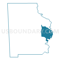
Cortelyou, Washington County, Alabama
About
Outline

Summary
| Unique Area Identifier | 523090 |
| Name | Cortelyou |
| County | Washington County |
| State | Alabama |
| Area (square miles) | 58.96 |
| Land Area (square miles) | 56.42 |
| Water Area (square miles) | 2.53 |
| % of Land Area | 95.70 |
| % of Water Area | 4.30 |
| Latitude of the Internal Point | 31.37497200 |
| Longtitude of the Internal Point | -87.96891270 |
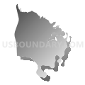
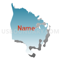
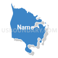
Maps


Graphs
Select a template below for downloading or customizing gragh for Cortelyou, Washington County, Alabama


Neighbors
Neighoring Voting District (by Name) Neighboring Voting District on the Map
- Carson/Preswick, Washington County, AL
- Leroy Fire House, Washington County, AL
- McIntosh Community Center Voting District, Washington County, AL
- Saltworks Voting House, Clarke County, AL
- Wagarville Fire House, Washington County, AL
Top 10 Neighboring County Subdivision (by Population) Neighboring County Subdivision on the Map
- McIntosh CCD, Washington County, AL (4,589)
- Wagarville CCD, Washington County, AL (3,353)
- Walker Springs CCD, Clarke County, AL (3,020)
Top 10 Neighboring Unified School District (by Population) Neighboring Unified School District on the Map
Top 10 Neighboring State Legislative District Lower Chamber (by Population) Neighboring State Legislative District Lower Chamber on the Map
Top 10 Neighboring State Legislative District Upper Chamber (by Population) Neighboring State Legislative District Upper Chamber on the Map
Top 10 Neighboring 111th Congressional District (by Population) Neighboring 111th Congressional District on the Map
Top 10 Neighboring Census Tract (by Population) Neighboring Census Tract on the Map
- Census Tract 442, Washington County, AL (4,589)
- Census Tract 441, Washington County, AL (3,353)
- Census Tract 9580.02, Clarke County, AL (1,731)